Make your maps here: http://www.arcgis.com!
Here’s a handy how-to https://learn.arcgis.com/en/projects/get-started-with-arcgis-online/
You can find some examples here: ArcGIS.com Map Gallery
And here is a gallery of StoryMaps for inspiration (although you don’t have to make yours this exciting).
And while there is a ton of data sets already available to add on ArcGIS.com – here’s a very long list of free data resources that are available to download and add to your map. I’ll help you! http://freegisdata.rtwilson.com
Other big resources: The Census -> http://census.gov/data.html, The US Geological Survey, http://nationalmap.gov, The Nature Conservancy http://maps.tnc.org
The Oregon Spatial Data Library & City of Bend Mapping Services.

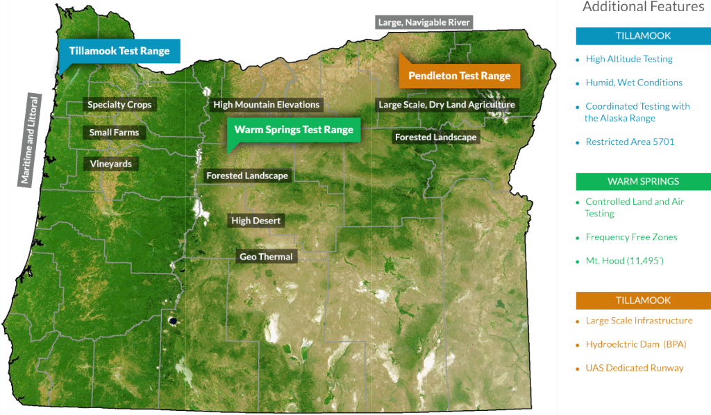
And if you want to know more about drones in Oregon, check out SoarOregon and the Cascade AUVSI.